Maps of Thaedros
Maps of Thaedros
The world of Thaedros spans a vast and varied landscape, from the towering mountain ranges that divide continents to the dense forests, sprawling plains, and treacherous wilds where civilization clings to existence. These maps provide a glimpse into the known geography of this post-Diaspora world.
The Known World
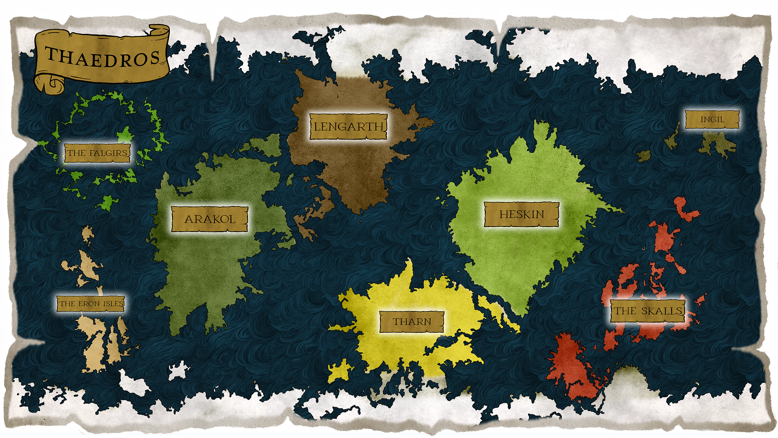
This world map shows the landmasses discovered by Encara's survivors—often at great cost. Only some of the most distant expeditions have returned with news of other continents, and fewer still have brought reliable cartographic information.
Settled Lands (as far as the Yldanian Surveyor's Guild knows):
- Arakol - The primary theater of civilization and conflict
- Lengarth - Settled, but the Guild has no maps of this region
- The Eron Isles - A wild, lush, mountainous jungle settled by the Genet and portions of the Ashaazi elves, who remain outside the reach of Yldan or the Imperium and have not shared their maps
Arakol - Continent Features Map
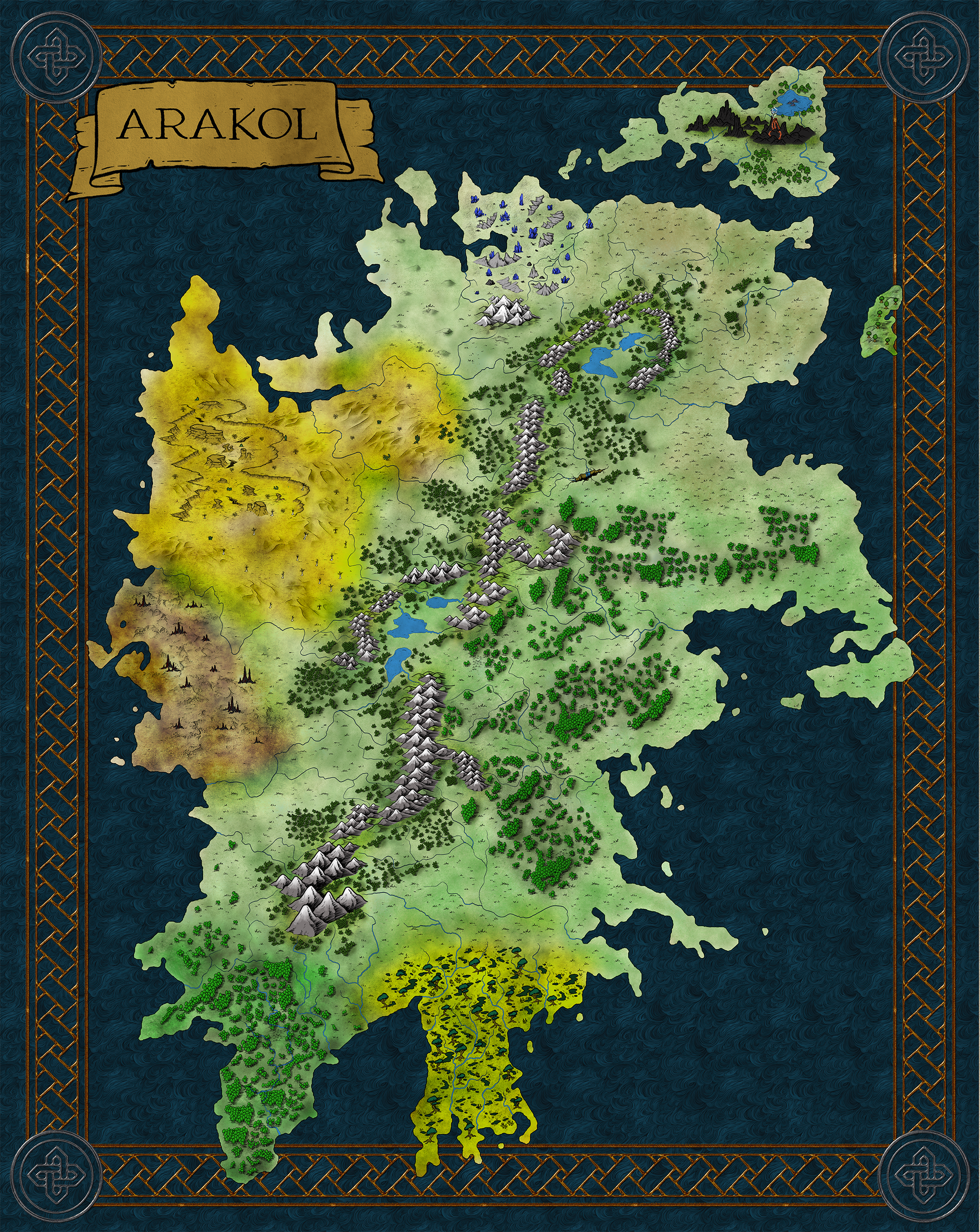
This detailed features map shows the landscape of Arakol, the continent where much of the action in Thaedros takes place. Mountain ranges, forests, plains, and waterways are rendered here to show the diverse terrain that shapes life in this region.
Major Regions of Arakol
While specific settlements will be detailed on the updated map, Arakol contains several distinct regions:
- Yldan - A major power in the east, currently in a cold war with the New Imperium
- The Frontier - Wild lands being explored and settled by the Yldanian Surveyor's Guild
- Ancient Essari Sites - Scattered ruins from the precursor civilization, holding secrets and treasures
- Contested Territories - Borderlands where factions vie for control and resources
Navigating Thaedros
The maps above represent current cartographic knowledge, but much of Thaedros remains unexplored or poorly documented. Ancient Essari structures emerge from overgrown forests, strange phenomena warp the landscape in unpredictable ways, and creatures from the Hungering Multitude—or worse—stake their claims in the wilds.
For adventurers, explorers, and surveyors, these maps are a starting point. What lies between the known settlements is often as important as the destinations themselves.
Exploring Thaedros
Explore some of the prominent locales on Thaedros, from the burgeoning cities of Yldan to the key outposts of the Yldanian Surveyors Guild at the very threshold of the unknown.
Lay of the Lands
The known world of Thaedros spans several major landmasses. Most campaigns begin on Arakol or Lengarth, but the drive to uncover lost history and seek answers may carry your adventures across seas and storm-swept islands, to jungles that resist exploration, and perhaps even to lands no one has returned from.